Mountains, rain, and internet logistics
Delhi in July is Really. Effing. Hot.
Granted, that's really, blindingly obvious for anyone who's ever been to India or knows the climate, myself included. Still, sometimes you need to spend a few days dripping sweat to remember how nice it would feel to go just about anywhere else. It's the kind of heat that makes spending two weeks in cool, drizzling rain surrounded by mountains sound absolutely fantastic. So we did.
Nainital, Bhimtal, and Sattal
Nainital is one of the most frequently recommended hill stations for Delhi-ites looking to escape the heat. It's a tourist destination, but one more geared towards domestic tourists than international ones. It's built around a beautiful lake surrounded by mountains, and one of the main attractions seems to be boating on it. David was pretty exciting by the boats.
David's Boat Saga
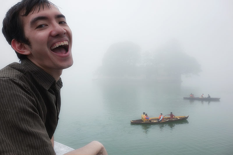
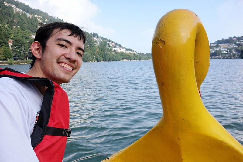
Well, maybe I exaggerated a little, but the boats were pretty fun. My personal favorite, though, was hiking up a nearby peak and looking down over Nainital through the clouds. On our way, we passed several groups of young students on their near-vertical walk to school, a few people hanging out on rooftops with drying laundry, and a random yet helpful guy on a horse. Once we made it to the trailhead, the path was also nicely deserted -- we only saw one other group during the entire hike.
Even though tourist season had slowed for Nainital, we still wanted to spend time somewhere a little less built up. We ended up going to Bhimtal and Sattal, two successively smaller towns also built around lakes (tal is a word for lake in Hindi, hence the naming scheme).
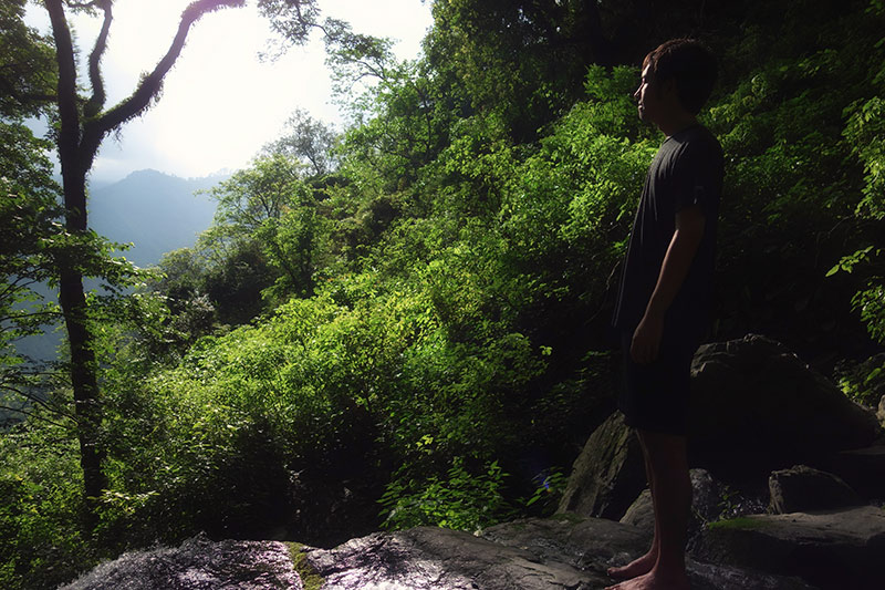
We only stayed in Bhimtal for a couple rainy days before moving on to Sattal. It was a perfectly nice town, but not much to write home (or blog) about. Sattal, on the other hand, was beautiful, tiny, and surrounded by deserted trails and small secluded lakes. Its name, Sat-tal, actually means "seven lakes," but we only managed to find four. We walked there from Bhimtal, a short and drizzly 5-ish kilometers by foot, although the road for cars is considerably longer.
Apart from relaxing in the government rest house (home-cooked breakfast and dinner included), we walked around the various lakes, went for a quick swim at the foot of some moss-covered steps leading to the water, and cooled our feet in a small pool overlooking a waterfall.
Internet Dependency
Sattal is advertised as a remote escape, completely apart from everyday life. One of the ways it accomplishes this is by completely lacking both internet and cell reception. For us, though, that was more or less our situation for the entire trip. My iPhone's GPS took anywhere from an hour to a couple days to update our current location, and internet was consistently hit-or-miss.
I generally think of myself as pretty good at unplugging. I go backpacking, I don't use my smartphone for much besides maps and yelp, and I'm fine leaving my computer behind for the occasional weekend trip. What I hadn't realized until now is that I'm really only good at unplugging when I don't have anything I need to plan or look up. Lacking Facebook or Twitter is peanuts compared to not knowing where you are, where you're staying for the night, or where to find food.
There were so many times I found myself reaching for my phone to look up directions from point A to point B, or hotel prices, or whether there were any ATMs close by. I did have the forethought to download an offline map of the area to my phone, but while google maps is so helpful in the U.S., it is woefully lacking in detail and riddled with inaccuracies when it comes to rural India.
We eventually ended up relying on "Indian GPS," otherwise known as asking someone for directions every time we hit a fork in the road. It's slightly more accurate than google maps, although not as much as one might think. For instance, when we asked how to walk from Bhimtal to Sattal, we got answers in the range of 3 km to 15 km, and were pointed down a few different roads. The trick seems to be to remove the outliers and pick the most common answer, which hopefully hovers around the mean. If the standard deviation is too high, then you know you need to ask a few more people (thanks Prof. Englebert, I bet you never imagined your data science lessons used in this context). Essentially, I've spent the past two weeks feeling like my plans are a fluffily opaque probability cloud instead of clear, linear path.
I know I've done this twice before, but sometime in the past few years I've become accustomed to having the collective wisdom of the internet always at my fingertips. Five years ago I refused to even have a GPS in my car while driving across the country because I thought half the fun lay figuring things out on the fly and taking the occasional wrong turn. Somehow, I've since turned into someone who always wants to know where they're going. It's been quite a while since I've felt lost or needed to navigate based on best guesses.